Latest News

2013
September 30, 2013

Online Mapping of NMRS Colliery Database

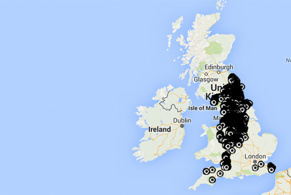
We have just made available the NMRS database of some 23,000 Collieries in the British Isles as an overlay on Google Maps & Earth. Clicking on a marker pin will reveal more information about that colliery including, its name (the name is already displayed on the Google Earth version), when it…
Read More
2013
September 23, 2013

Archaeological Excavation of a Potential Bale Site

A potential lead bale site at SE 05939 99141 was found in 2012 and was excavated as a joint project in the summer of 2013 by the Swaledale and Arkengarthdale Archaeology Group (SWAAG) and the Northern Mine Research Society (NMRS) under the supervision of professional archaeologist, Tony Liddell of Vindomora…
Read More