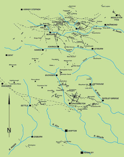
The Mid Pennine area stretches from Keighley in the south to around Kirkby Stephen in the north and encompasses the hills of the Pennine chain.
This area can be subdivided into:
- The Northern Area, based on Wensleydale and Swaledale
- The Southern Area, which includes Wharfedale, Nidderdale and Airedale
Each has a wide range of large and small mines.
A few ingots of Roman lead have been found in both areas, but most mining came after the Norman Conquest when there was demand for lead as castles and monasteries were built.
The later mediaeval period also saw Yorkshire lead being exported to Baltic and North Sea ports By then, large areas of the Yorkshire Dales were monastic estates, and mines were worked there energetically.
The mines were mainly shallow shafts, sunk onto the outcrops of veins, and worked under a form of customary law, with meers granted to working miners and entrepreneurs. After the dissolution of the monasteries, however, the estates were sold off by the crown and new owners often suppressed laws, keeping only those parts which conveniently fit with new forms of regulation. Nevertheless some areas of upper Wharfedale continued to use such laws into the nineteenth century.
There are other small mines around this area which are not included on the maps:
- Anglezarke Lead Mine near Chorley, working from 1594
- Bowland Lead Mines near Dunsop Bridge (please note that some of these mines are on private land)
- Thievely Lead Mine near Burnley, working from 1629
Each has a wide range of large and small mines. Please also see the Smelting Mills of the Yorkshire Dales
Return to previous page