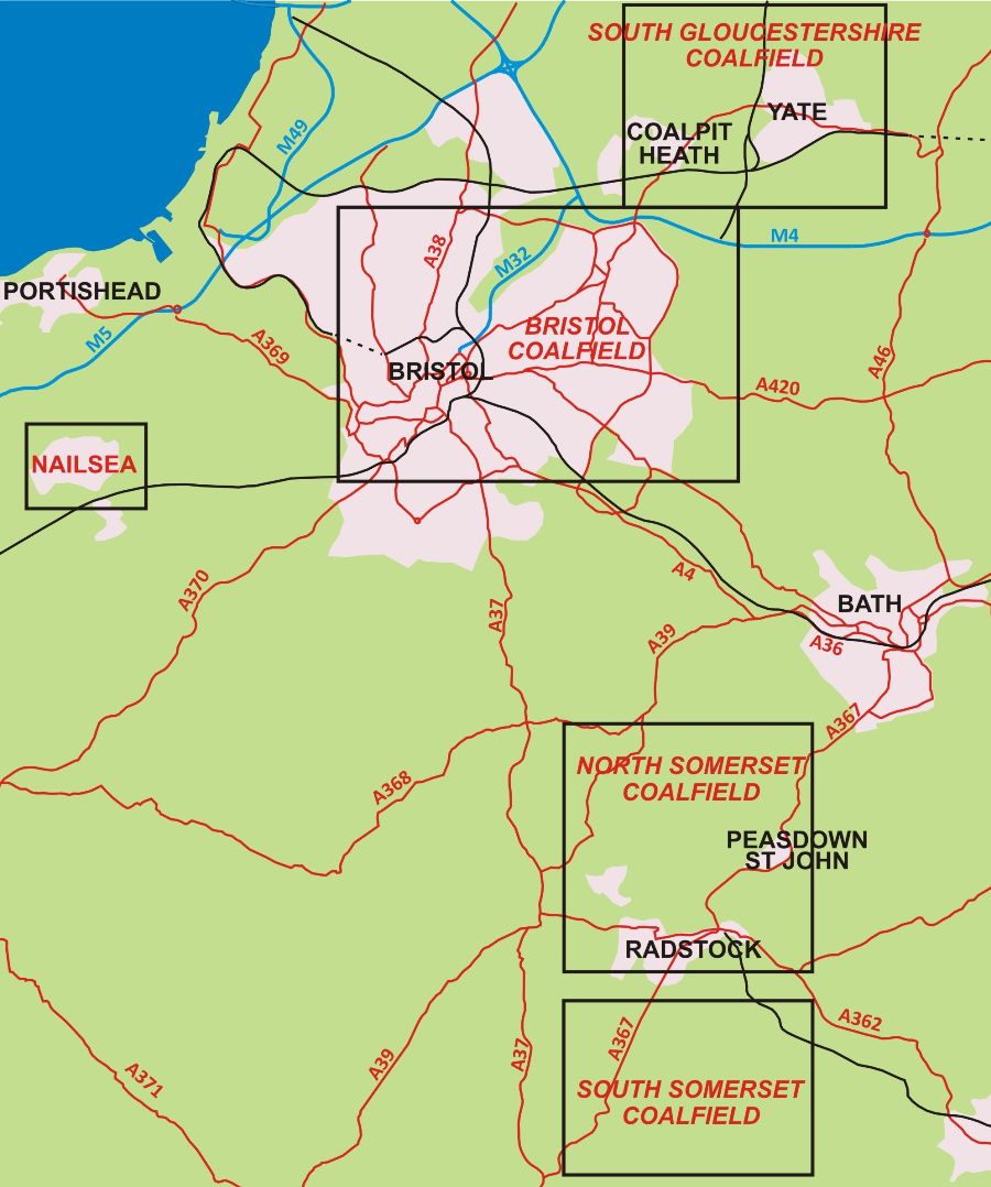
The Bristol coalfield runs north-east from the Bedminster area, under what are now the eastern suburbs of Bristol, to Yate, and is associated with the Coalpit Heath syncline and the Kingsdown anticline. Two smaller, satellite coalfields were also worked. The Severn Coalfield, in the Avon Mouth basin, lies five miles north-west of the city centre and runs under the Severn estuary to Portskewett. The Nailsea coalfield lies within a syncline seven miles west of the city centre. A small inlier of coal measures has also been worked at Clapton in Gordano.
These coalfields are rich in eighteenth and early nineteenth century remains and have been studied by the South Gloucestershire Mines Research Group and the Bristol Industrial Archaeological Society. As well as books, there are papers in the Journal of the Gloucestershire Society for Industrial Archæology and the Proceedings of the Somerset Archæological and Natural History Society and the Industrial Archæology Review.1-4
To the south, the Bristol coalfield appears to have been left unworked in a syncline before re-emerging in Somerset, where it was extensively worked. This coalfield is roughly rectangular, eight miles wide by seven high, and centred on Midsomer Norton.5
- Anstie, J. The Coal Fields of Gloucestershire and Somersetshire (Bracknell: Forge Books, 1965). Facsimile of 1873 edition.
- Cornwell, J. Collieries of Somerset & Bristol (Ashbourne: Landmark Publishing Co., 2001)
- Cornwell, J. The Bristol Coalfield (Ashbourne: Landmark Publishing Co., 2003)
- Down & Warrington , C.G. & A.J. The history of the Somerset Coalfield (Newton Abbot: David & Charles, 1971)
- Gould, S. The Somerset Coalfield (Somerset Industrial Archaeology Society Survey 11, 1999)
