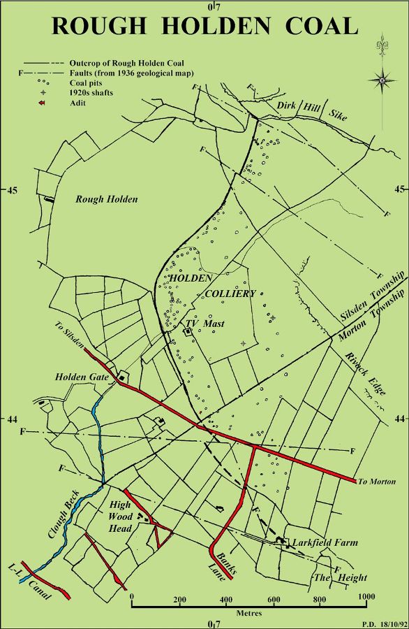
The Rough Holden Coal, in the shales about six metres below the Guiseley Grit, varied in thickness from zero to 1.5 m.
The seam outcrops on the west side of Rivock Edge, above Riddlesden, and runs southwards, for about 1.6 km, from the Rivock Fault at Dirk Hill Sike (SE072453) to near the junction of the Silsden to Morton road with Banks Lane (SE070440).
A faulted extension, some 530 metres south-east of the road junction is shown on the 1876 and 1936 Geological Survey maps. The 1936 map also shows a further 200 metres of uncertain outcrop near Heights Farm.
Gill, M.C. “Great Dales Coalfield, Eastern Areas” British Mining No.86 (2008), pp.68-108
Gill, M.C. Keighley Coal (British Mining No.74, 2004)
Return to previous page