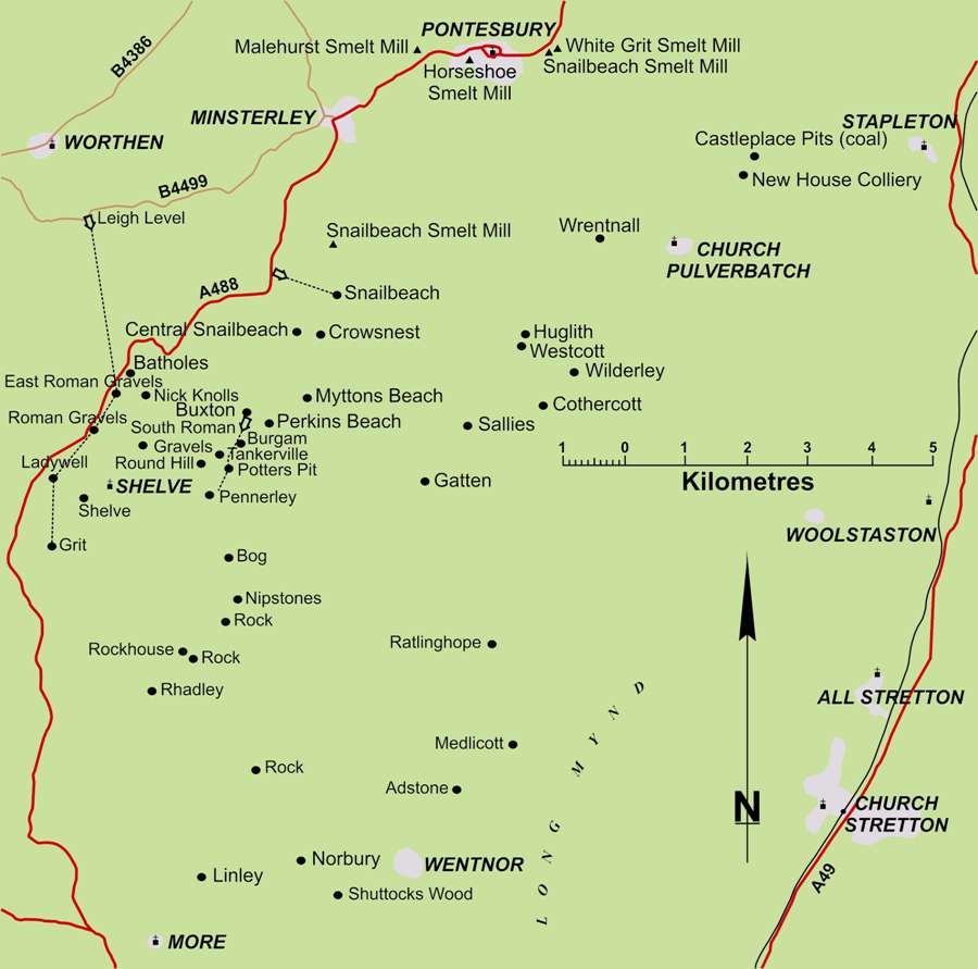
The principal lead, zinc and barytes mining area in this county lies immediately south of Minsterley. Here, the parallel axes of the Shelve anticline and the closeby Ritton Castle syncline run south-west to north east, and erosion has left two, roughly parallel, outcrops of Mytton Flags, which were the principal source of lead ore. The flags are of Ordovician age (492-435 Million Years). To the east of this, a group of mines, around Huglith and Cothercott, worked barytes and a little copper in Precambrian sandstones and mudstones (570+ Million Years).Some copper ore was won from mines at Clive and Eardiston, which are part of an east to west group of deposits, in Triassic sandstones, about 20 km north of Minsterley.Shropshire is unlike most other lead mining areas because its ore deposits cover much greater vertical distances, being more like those in the south-west. This meant that adits were of limited use for drainage, but eighteenth and some early nineteenth century mines pumped using waterwheels. The proximity of the Pontesbury coalfield also made the widespread use of steam pumping and winding engines cost effective. This has left a legacy of ruined engine houses. Because there was little or no peat, smelt mills were established on the coalfields at Pontesford or in the Severn Gorge near Iron Bridge.Snailbeach Mine (in the village of Snailbeach near Minsterley, off the A488) is open most Sundays from June to September, plus some other Bank Holidays.Index of articles published by the Northern Mine Research Society, complied by Alasdair Neill
Return to previous pageShropshire Mines