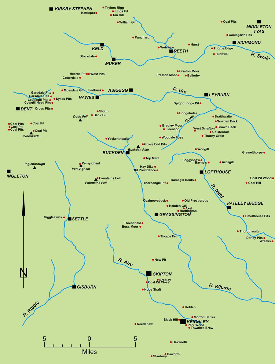
The two largest areas where non-Westphalian coal was worked are both in the Pennines. The northern one, centred on the Alston Block, was dominated by workings in the Little Limestone and Coalcleugh coals. The southern one, centred on the Askrigg Block, includes coalfields within the Lune drainage (f), as well as the Craven Basin and South Craven to the south (e). It also goes as far as the Permian outcrop to the east. This overall area has no convenient descriptor so, for ease, it has been called the Yorkshire Dales. Here workable seams were found at, at least, fourteen geological horizons. There have been two recent overviews of coal mining in this area (see maps), with the western draining areas covered by Kelly and the eastward draining ones covered by Gill.1,2
The coal developed where the water had become shallow enough for swamps to form. Rather than the very extensive bogs formed during Coal Measures times, however, one must envisage an active paleo-surface of river channels, sand banks, flood plains and lagoons, in which coal swamps formed on sand or mud substrates. It is possible, therefore, for seams to be broadly coeval but not necessarily conjoined. Periodic incursions of sediment-rich water into the lagoons from the river channels, or sea, led to the Dales’ coals having a generally high ash content. This probably explains the areas of ‘poor coal’ shown on many plans of Dales’ coal mines. Some seams were reportedly highly sulphurous in places, which was probably caused by the contamination of the swamp by marine incursions. In time, the swamps were covered by sand or mud and, under anaerobic conditions, coalification took place.
Many might consider such coalfields to be so highly marginal as to be of little interest. Nevertheless, it must be remembered that, as part of the symbiotic relationship between coal mining, lime-quarrying and burning and farming, they often supported mines of significant local importance.
The most extensive horizon for coal was the seam associated with the Grassington Grit, in the Pendleian substage of the Namurian stage. This horizon is called the Brennand Grit on the Lancaster Fells, the Lower Howgate Edge Grit in the north-western area and the Warley Wise Grit in South Craven.
Some mines in more detail:
- Tan Hill
- Colsterdale
- Preston Moor (Grinton)
- Morton Banks (Keighley)
- Holden (Keighley)
- Threshfield
1. Kelly M. Geology of the Lune and Upper Ribble Coalfields, British Mining No.85, 2008
2. Gill, M.C. “Great Dales Coalfield, Eastern Areas” British Mining No.86 (2008), pp.68-108
